Northern Wisconsin and Minnesota Flood July 2016
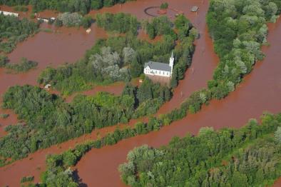
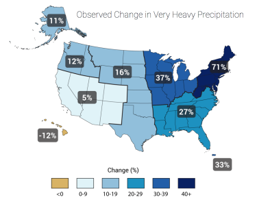
A powerful storm system with "tornadic-strength winds" brought as much as 10 inches of rain to Northern Wisconsin and Minnesota on July 11 and 12, causing record river crests, infrastructural damage estimated in the millions and two reported fatalities. Climate change increases the risk of flooding by increasing the frequency of extreme precipitation. Warmer air holds more water, leading to stronger and more frequent heavy precipitation events, a global trend that has been firmly attributed to climate change. In the upper Midwest region of the US that includes Wisconsin and Minnesota, extreme precipitation has increased 37 percent from 1958 to 2012.
Heavy rains and record river crests point to rising flood risk
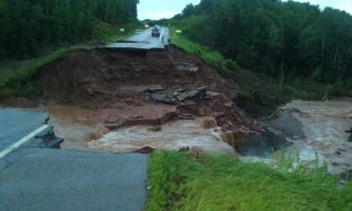
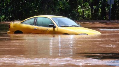
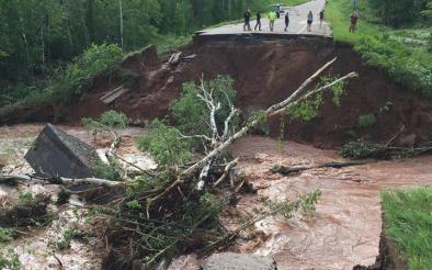
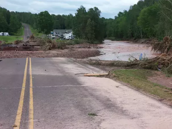
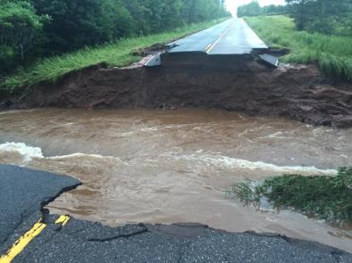
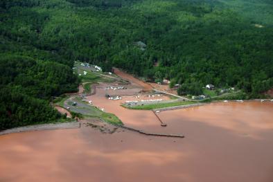
Multiple rounds of showers and thunderstorms with "tornadic-strength winds" hit northeast Minnesota and northwest Wisconsin overnight on July 11 and 12, causing two fatalities, swamping harbors and washing out roads. On July 12, Governor Scott Walker of Wisconsin declared a state of emergency in eight northern Wisconsin counties.[1]
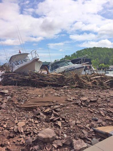
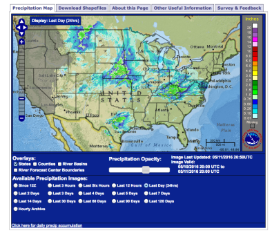
Official rain totals (as of 7AM July 12) in several northern Wisconsin and Minnesota cities neared the 10 inch mark, with Wascott, Wisconsin registering the highest amount at 10.0 inches exactly.[2] Saxon Harbor, where two creeks spill into Lake Superior, may have seen overall rainfall totals approaching 14 inches, which caused destructive flash flooding, costing millions of dollars in damage to infrastructure and leaving one person dead.[3][4] In nearby Bayfield County, a second life was lost to the storm when a man became trapped in his submerged vehicle.[3]
Brainerd, Minnesota reported 8.9 inches of rain between the night of July 10 and the early morning of July 12.[2] The city typically sees 7.66 inches of rain on average during the months of May and June combined, making 8.9 inches the most rain Brainerd has seen in a short amount of time since the station there began keeping records back in 1908.[5]
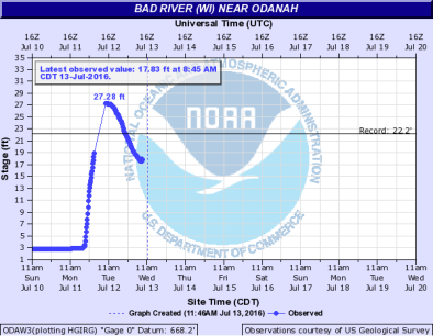
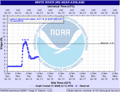
The heavy rainfall led to two record river gauge readings. The White River near Ashland rose to 8.54 feet[6]—topping the previous record of 7.9 feet set in 1953—and the Bad River near Odanah rose to 27.28 feet[7]—topping the 1946 record of 22.20 feet.[8]
Extreme rainfall events such as this are becoming more common and more intense as the world warms
Climate change contributes to increased flooding because warmer air holds more water, leading to stronger and more frequent precipitation events.
In the upper Midwest region of the US—an area that includes Wisconsin and Minnesota—extreme precipitation has increased 37 percent from 1958 to 2012.[9]
 A November 2013 study analyzing extreme precipitation trends in Wisconsin from 1950 through 2006 finds that storms in the 99th percentile—the heaviest 1 percent of all storms—show the strongest increasing trend across the largest area, whereas less extreme storms generally show a decrease.[10] This is consistent with the physics of what we'd expect in a warming world. A warmer atmosphere that holds more water will also dump more water when it rains.
Moving forward, a study assessing the effects of climate change on precipitation and flood damage in Wisconsin finds that heavy 24-hour storms (with rainfall totals likely to happen just once every 100 years) will increase by 11 percent across the state by the mid-21st century.[11]
Related Content