Catastrophe 'a matter of time': Spring brings more fears for Missouri River flooding
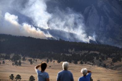
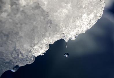
Climate Signals Summary: Climate change is increasing the risk of flooding by increasing the frequency and intensity of extreme rainfall events, as well as increasing total precipitation in some regions, including the Midwest. In the spring of 2019, there was severe flooding in the Mississippi River Valley and the Missouri River basin.
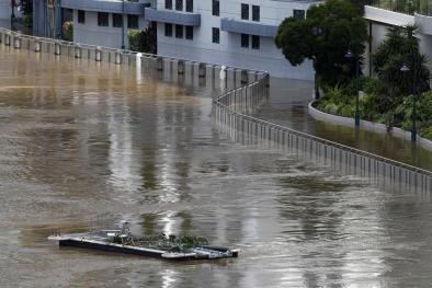
Article Excerpt: The church’s move was one of the countless consequences of flooding last year that battered the river’s levee system, inundating towns and farmland and causing multiple closures to the region’s interstate highway system.
And while the Ebenezer faithful pray they might be able to rebuild in their town, a more immediate concern is what could happen this year when the spring snowmelt and rains make their way to the river.
The forecast is a veritable index of meteorological plagues: above-normal rainfall; greater than normal spring runoff; thoroughly saturated soils; and an aging system of nearly a thousand levees where nobody knows how many were damaged last year and in previous floods or how many were repaired.
The 855 levee systems throughout the Missouri River basin protect at least half a million people and more than $92 billion in property. Yet a USA TODAY Network analysis of Army Corps of Engineers’ records found at least 144 levee systems haven’t been fully repaired and that only 231 show an inspection date.
...
The 2,300-mile Missouri River begins in southwestern Montana, where the Gallatin, Madison and Jefferson rivers converge near the community of Three Forks, before gathering water from 10 states and parts of two Canadian provinces to become the “Big Muddy,” North America’s longest river.
In recent years, more rainfall has been pouring into the Missouri River basin, raising questions about whether climate change is bringing worsening floods more often. Data from the National Oceanic and Atmospheric Administration dating back to 1895 shows record-setting rainfalls in the area occurring more often. Last year, for example, was the wettest on record in North Dakota, South Dakota and Minnesota.
...
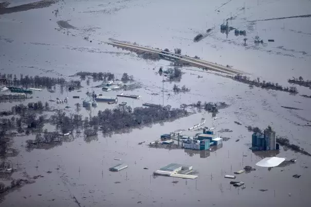
Things came to a head last year when a bomb cyclone in March melted all the snow in Nebraska and Iowa at once and dumped tremendous rain, swelling not just the Missouri, but the Elkhorn, Platte, James and Big Sioux rivers.
The Niobrara River in Nebraska breached the Spencer Dam on March 14, sending a wall of water downstream and into the Gavins Point reservoir near Yankton, South Dakota. At the peak, water flowed into the reservoir at 180,000 cubic feet per second – nine times more than the normal average for March. Meanwhile, water was coursing into the rivers downstream of the dam and the effects of all that water were felt in nearly every community downstream.
Two other big rain events occurred in May and September. When the Corps’ Kansas City district deactivated its emergency operations center in December, it had been open for 279 days, the longest period on record.
...
But the projections for spring runoff don’t look good and may limit how much the Corps can do.
In February, the runoff was twice the normal average, said Kevin Grode, with the Corps’ Missouri River Basin Water Management Division.
The James River, a tributary that flows out of South Dakota, has experienced flooding since March 13 last year and that flooding is forecast to continue. Moderate flooding is expected along the Big and Little Sioux Rivers in South Dakota and Iowa, and possibly in Montana’s Milk River basin. A risk of minor to moderate flooding is forecast from Nebraska City to the river’s confluence with the Mississippi in St. Louis.
But it’s not just the spring runoff that’s a problem, Grode said. The forecast also calls for “above average runoff for every month in 2020.”
John Remus, chief of the Corps’ Missouri River Water Management Division, said during a March briefing that if those projections are realized, “the 2020 runoff will be the ninth highest runoff in 122 years of record-keeping.”
...
As of Wednesday, mountain snowpack in the Missouri River basin in Montana was 112% of normal, said Lucas Zukiewicz, a water supply specialist with the Department of Agriculture’s Natural Resources Conservation Service in Montana.
In 2018, Montana’s April snowpack was 150% of normal, then 7 to 9 inches of rain over six days drenched the Rocky Mountain Front, inundating communities in its shadow. The Corps was forced to release water from the Fort Peck Dam spillway, a rarity, as a result of surging flows. Had that same thing happened last year, flooding in states downstream would have been even worse.
“With the way things are changing with our climate,” said Arin Peters, a senior hydrologist for the National Weather Service in Great Falls, Montana, “it’s probably a matter of time before something combines to create a big catastrophe downstream.”
Related Content