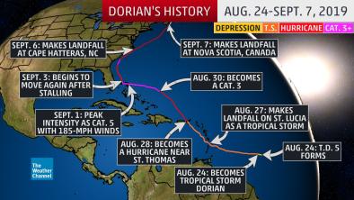
Maps: Track Hurricane Dorian’s Path
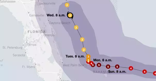
A hurricane warning was extended to about 180 miles of the Florida coast. The storm is also projected to approach South Carolina and Georgia as a major hurricane. In North Carolina, state officials warned that heavy rain could cause dangerous flooding beginning Wednesday evening.
Storm surge was expected from Florida to North Carolina as of Tuesday, and could cause ruinous flooding and wipe out roads and beaches.
...
On Saturday, with the predicted path of the storm now changed, the governor of South Carolina declared a state of emergency as well, followed by similar declarations for North Carolina and parts of Georgia. With the lack of clarity on where the storm will hit, Florida residents wrestled with the question of whether to stay or evacuate.
Related Content