Science Source
BAMS State of the Climate 2016
Report highlights include these indications of a warming planet.
- The global annual average atmospheric CO2 concentration was 402.9 parts per million (ppm) in 2016, which surpassed 400 ppm for the first time in the modern atmospheric measurement record and in ice core records dating back as far as 800,000 years. This was 3.5 ppm more than 2015, and it was the largest annual increase observed in the 58-year record.
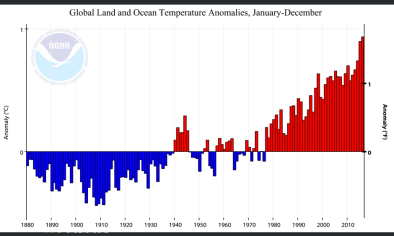
- Global surface temperature highest on record. Aided by the strong El Niño early in the year, the 2016 annual global surface temperature observed record warmth for a third consecutive year, with the 2016 annual global surface temperature surpassing the previous record of 2015.
- Global lower tropospheric temperature highest on record. In the region of the atmosphere just above the Earth’s surface, the globally averaged lower troposphere temperature was highest on record.
- Sea surface temperatures highest on record. The globally averaged sea surface temperature was the highest on record. The more recent global sea surface temperature trend for the 21st century-to-date (2000–2016) of +2.92°F (1.62°C) per century is much higher than the longer term (1950–2016) warming trend of +1.8°F (1.0°C) per century.
- Global upper ocean heat content near-record high. Globally, upper ocean heat content saw a slight drop compared to the record high set in 2015, but reflected the continuing accumulation of thermal energy in the top 2,300 feet (700 meters) of the ocean. Oceans absorb more than 90 percent of Earth’s excess heat from global warming.
- Global sea level highest on record. Global average sea level rose to a new record high in 2016 and was about 3.25 inches (82 mm) higher than the 1993 average, the year that marks the beginning of the satellite altimeter record. This also marks the sixth consecutive year, global sea level has increased compared to the previous year. Over the past two decades, sea level has increased at an average rate of about 0.13 inch (3.4 mm) per year, with the highest rates of increase in the western Pacific and Indian Oceans.
- Extremes were observed in the water cycle and precipitation. A general increase in the water cycle (the process of evaporating water into air and condensing it as rain or snow), combined with the strong El Niño, enhanced the variability of precipitation around the world. In addition to many parts of the globe experiencing major floods in 2016, for any given month at least 12 percent of global land was experiencing at least “severe” drought conditions, the longest such stretch in the record. Drought conditions were observed in northeastern Brazil for the fifth consecutive year, making this the longest drought on record in this region. The increased hydrologic cycle was also reflected, as it has been for more than a decade, by patterns of salinity (saltiness) across the globe’s ocean surface.
The report also documents key regional climate and climate-related events.
- The Arctic continued to warm; sea ice extent remained low. The average Arctic land surface temperature was 3.6°F (2.0°C) above the 1981–2010 average, breaking the previous record of 2007, 2011 and 2015 by 1.4°F (0.8°C), representing a 6.3°F (3.5°C) increase since records began in 1900. Average sea surface temperatures across the Arctic Ocean during August in ice-free regions ranged from near normal in some regions to around 13° to 14°F (7° to 8°C) above average in the Chukchi Sea and eastern Baffin Bay off the west coast of Greenland, and up to 20°F (11°C) above average in the Barents Sea. Increasing temperatures have led to decreasing Arctic sea ice extent and thickness. On March 24, the smallest annual maximum sea ice extent in the 37-year satellite record was observed, tying with 2015 at 5.61 million square miles, 7.2% below the 1981–2010 average. On September 10 Arctic sea ice annual minimum extent tied with 2007 for the second lowest value on record, at 1.60 million square miles, 33 percent smaller than average. Arctic sea ice cover remains relatively young and thin, making it vulnerable to continued extensive melt.
- Antarctic sees record low sea ice extent. During August and November, record low daily and monthly sea ice extents were observed, with the November average sea ice extent significantly smaller (more than 5 standard deviations) than the 1981–2010 average. These record low sea ice values in austral spring 2016 contrast sharply with the record high values observed during 2012–2014.
- Global ice and snow cover decline. Preliminary data indicate that 2016 was the 37th consecutive year of overall alpine glacier retreat across the globe, with an average loss of 2.8 feet (852 mm) for the reporting glaciers. Across the Northern Hemisphere, late-spring snow cover extent continued its trend of decline, with new record low April and May snow cover extents for the North American Arctic. Below the surface, record high temperatures at the 20-meter (65-feet) depth were measured at all permafrost observatories on the North Slope of Alaska and at the Canadian observatory on northernmost Ellesmere Island.
- Tropical cyclones were well above average overall. There were 93 named tropical cyclones across all ocean basins in 2016, well above the 1981–2010 average of 82 storms. Three basins – the North Atlantic and eastern and western North Pacific – experienced above-normal activity in 2016. The Australian basin recorded its least active season since the beginning of the satellite era in 1970.
Related Content
Real Time Data

Mar 15, 2017 | Global Historical Climatology Network–Daily (GHCN-D)
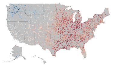
US Annual Average Temp as Departure from Normal
Headline

Jan 19, 2017 | Category 6
Confirmed: 2016 the Warmest Year in History of Global Recordkeeping
Headline

Jan 19, 2017 | Los Angeles Times
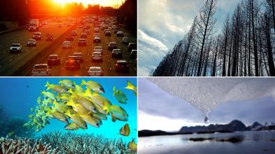
Wildfires, sea level rise, coral bleaching: Climate change is already here
Headline

Jan 18, 2017 | Met Office
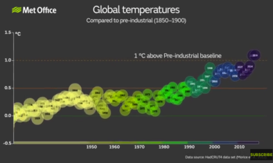
2016: one of the warmest two years on record


