Science Source
Flood Runoff in Relation to Water Vapor Transport by Atmospheric Rivers Over the Western United States, 1949–2015
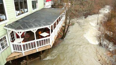
- States that atmospheric rivers (ARs) have a significant role in generating floods across the western United States
- Analyses daily streamflow for water years 1949 to 2015 from 5,477 gages in relation to water vapor transport by ARs using a 6 h chronology resolved to 2.5° latitude and longitude
- Finds that the probability that an AR will generate 50 mm/d of runoff in a river on the Pacific Coast increases from 12% when daily mean water vapor transport, DVT, is greater than 300 kg m−1 s−1 to 54% when DVT > 600 kg m−1 s−1
- Finds that extreme runoff, represented by the 99th quantile of daily values, doubles from 80 mm/d at DVT = 300 kg m−1 s−1 to 160 mm/d at DVT = 500 kg m−1 s−1
- Concludes that forecasts and predictions of water vapor transport by atmospheric rivers can support flood risk assessment and estimates of future flood frequencies and magnitude in the western United States
Related Content
Headline
Feb 14, 2019 | The Weather Channel
California Rain Triggers Evacuations, Mudslides; Woman Rescued from Sausalito Home
Headline

Feb 14, 2019 | Reuters
Mudslide risk from California storm forces hundreds to evacuate
Headline
Feb 13, 2019 | San Francisco Chronicle
Heavy storms shuts down SFO flights, floods roadways across region
Headline

Feb 13, 2019 | LA Times
As atmospheric rivers pound California, here comes the season’s ‘biggest storm’
