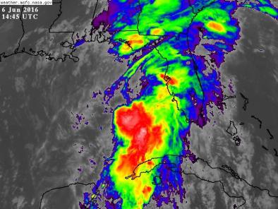
Tropical Storm Colin 2016
Tropical Storm Colin formed five days into the Atlantic hurricane season, just as Tropical Storm Bonnie, which had arrived five days ahead of the season's official start, dissipated. Colin marks the earliest arrival of the third tropical storm in the Atlantic hurricane season, thanks to unusually warm waters that have helped to fuel the early season storms.
Global warming has been found to increase the rainfall associated with hurricanes. In addition sea level rise is elevating the storm surge driven by hurricanes. There is also a significant risk that ocean warming may be directly increasing hurricane intensity.

El Niño and climate-warmed waters linked to early action in the Atlantic
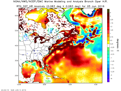
Colin is the earliest third tropical storm to form in the Atlantic, beating the previous record set in 1887 by seven days.[1] Like Tropical Storm Bonnie before it,[2] Colin gained strength thanks to unusually warm waters in the Caribbean and Gulf of Mexico. Surface waters in the Gulf of Mexico were around 1.8°F (1°C) above average during Colin's formation.[3]
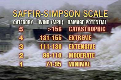
Though Colin's wind speeds are not hurricane strength—tropical storms have maximum sustained wind speeds up to 73 mph, after which the storm is upgraded to a Category 1 hurricane—Tropical Storm Colin is the same kind of storm, driven by sea surface temperatures.[4]
Sea level rise elevates storm surge flooding in coastal communities
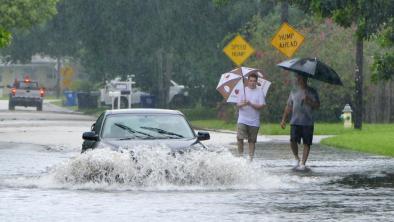
Sea levels have risen considerably,[5] resulting in higher storm surge that penetrates much further inland. Large storms tend to drive coastal flooding, especially when they occur at times of high tide.[5] The damages wrought by heavy rain and storm surge are often much worse than the damage from heavy winds.
In Cedar Key, Colin's storm surge reached 2.95 feet and the storm tide, 5.17 feet, placing 8th highest on record, a top-ten standing made possible only by addition of sea level rise.
Global warming fuels extreme rainfall during storms
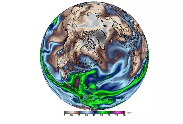
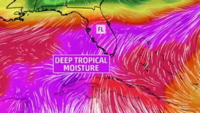
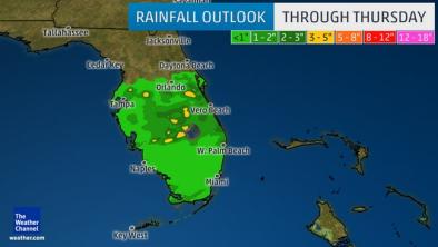
Tropical storms and even tropical depressions can be prolific rain makers.[7] And as the global temperature increases, so too does the ability of the atmosphere to hold water vapor and dump more precipitation when it rains.[8] Storms reach out and gather water vapor over regions that are 10-25 times as large as the precipitation area, thus multiplying the effect of increased atmospheric moisture.[8] As water vapor condenses to form clouds and rain, the conversion releases heat that add buoyancy to the air and further fuels the storm.[9] This increases the gathering of moisture into storm clouds and further intensifies precipitation.[8]
As the planet warms, the frequency of intense storms is likely to increase
Warming sea surface temperatures have been linked to an increase in hurricane intensity, while possibly decreasing the frequency.[10]
The trade-off in frequency for greater intensity likely results in greater overall damage as the wind damage incurred by a hurricane increases geometrically with the increase in wind speed.
Cooler ocean basins, like the North Atlantic, with larger temperature increases in recent years show the greatest upward trend in hurricane intensity.[11]
Related Content