Houston Floods April 2016
Record-breaking rainfall brought deadly floods to Houston in mid-April 2016, the fourth major flooding event in the city in less than 12 months. Houston has seen a 167 percent increase in heavy downpours since the 1950s. One of the clearest changes in weather globally and across the United States is the increasing frequency of heavy rain.

Houston flooding bears the classic signatures of climate change
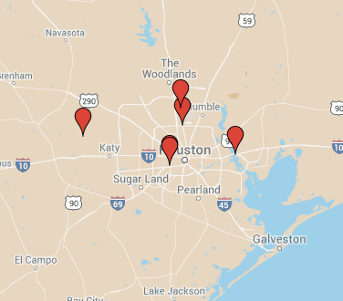
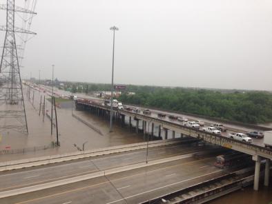
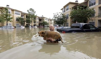
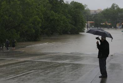
Heavy rains and flooding in Houston took nine lives and put much of the city under water in mid-April 2016.[1] Dozens of schools, roads and freeways were closed after rainfall dumped more than a foot of water.
There were multiple locations that had annual 1-in-1,000 year rainfall.[9]

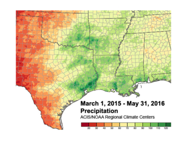
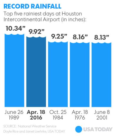
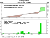
The record-breaking rainfall that drove Houston’s deadly floods parallels the trend toward more extreme rainfall in our warming world. Houston has seen a 167 percent increase in heavy downpours since the 1950s.[2] The nearly 10 inches of rain recorded at Houston’s airport during this flood was the highest one-day April rainfall since airport record-keeping began, and was also the second highest one-day record in any month.
One of the clearest changes in weather globally and across the United States is the increasing frequency of heavy rain.[3] A warmer atmosphere holds more water vapor. And like a bigger bucket, a warmer atmosphere dumps more water when it rains. The storm in Houston was supercharged by running through an atmosphere made wetter by global warming.
Over the past century the US has witnessed a 20 percent increase in the amount of precipitation falling in the heaviest downpours. And the increase in extreme precipitation has dramatically increased the risk of flooding.
The increasing number of record-breaking heat waves and intense rainfalls is a hallmark of climate change. Records tend to be broken when natural variability runs in the same direction as climate change, towards extreme rainfall in the case of the Houston flood. The extreme rains in Houston carry that hallmark, smashing the city’s one-day rainfall records.
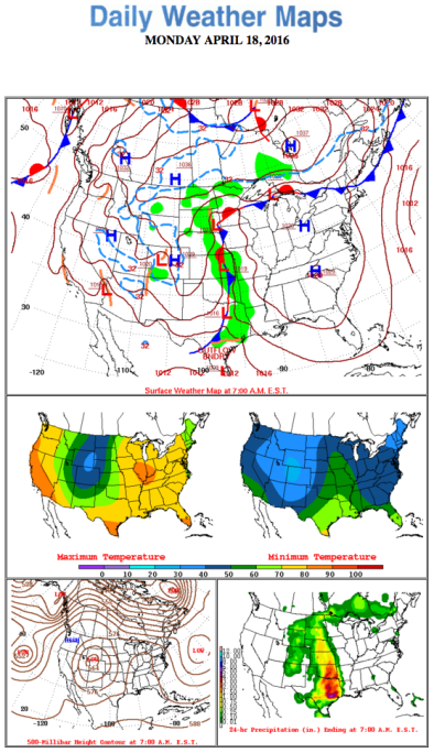
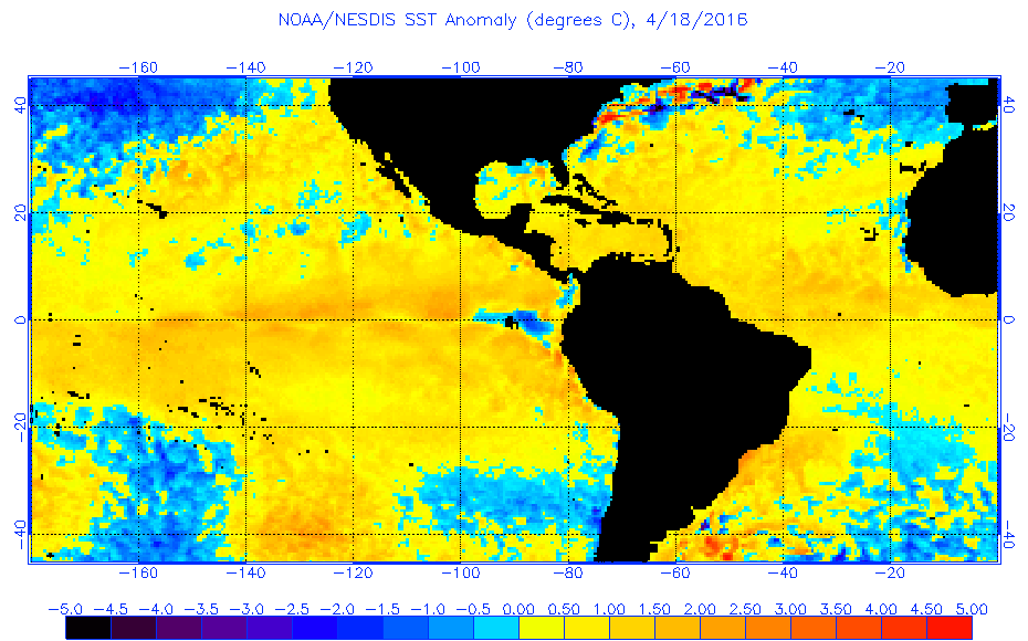
Global warming also contributes to higher sea temperatures that in turn feed more moisture and energy into storms and weather systems. The Houston storm was fed by moist winds coming off the Gulf coast where sea surface temperatures are running hot, bumped up by global warming. On April 18, sea surface temperatures in the US gulf were up to 1.8°F (1°C) above normal.
Finally, there is mounting evidence that blocking weather patterns such as witnessed in the Houston event may be happening more often due to climate change, boosting the likelihood of heavy rainfall events in which storms stall over one area.[4]
Climate context: by the numbers
-
Houston has seen a 167 percent increase in heavy downpours since the 1950s.[2]
-
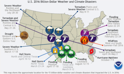
This is at least the fourth major flood in the Houston area in just the past 12 months, with previous flooding events last May,[5] June,[6] and October[7] pummeling Texas hard.
-
The amount of rain falling in the heaviest events has increased by 16 percent since the 1950's across the Great Plains, according to the Third US National Climate Assessment.[3]
-
Across the US, 8 of the top 10 years for extreme one-day precipitation events have occurred since 1990, according to NOAA data.[8]
Historic storm: by the numbers
-
The 9.92 inches of rain at Houston Intercontinental Airport on April 18 was the highest one-day April rainfall on record, and is also the highest one-day record ever except for June 26, 1986 when Houston was hit by the first Tropical Storm Allison.
-
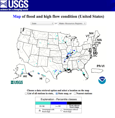
At least one watershed in Harris county set a new all-time record, cresting 0.4 feet above its estimated 500-year flood mark. More than half the watersheds in Harris County are experiencing significant flooding.
Related Content


