Recent Winter Weather Pattern Is Concerning in Parts of the Lower 48
Signals Summary: Climate change is increasing the frequency of extreme rainfall events, but in some places, including the Southwest, it is also decreasing the total amount of precipitation, which increases the risk of drought and snowpack decline. In addition, warmer winter temperatures from climate change can cause plants to bloom early, which is currently being seen in much of the South.
Article Excerpt: The weather pattern that has dominated the Lower 48 since the start of 2020 is beginning to increase concerns of drought, flooding, lack of ice and early spring blossoms.
...
The track of the jet stream has kept parts of the Southwest drier than average since the start of the year. The jet stream has focused the storm track farther north into the Pacific Northwest and Canada, generally missing California.
This dry pattern has prompted abnormally dry areas to develop in portions of California, while drought has persisted in much of the Four Corners. Drought also remains in parts of Texas.
This is typically a wet time of year in California but little precipitation has been observed.
...
There has been a lack of snowfall, as well. The snow water equivalent (the amount of water in the snowpack) is only about 50 to 70 percent of average in the Sierra Nevada.
Portions of Arizona and New Mexico are also well below average in terms of snowpack, which is very important for water needs during the dry months.
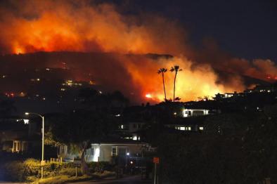
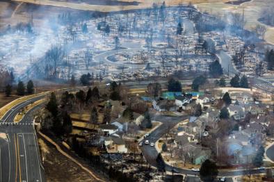
If this dry pattern continues for the remainder of the wet season then the concern for drought and wildfires will increase heading into the summer.
...
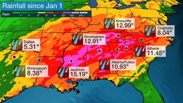
The recent upper level weather pattern has brought rounds of rain to the South as systems combine with moisture from the Gulf of Mexico.
A strong system brought very heavy rainfall to parts of the Southeast on Feb. 6, causing widespread flooding across the region.
...
The wet pattern looks to continue and more rainfall is ahead for the South and several rivers are already in moderate to major flood stage.
Additional rainfall on saturated ground, combined with rivers and streams that are already running high, will increase the risk for more flooding.
...
Leaves and blossoms are often the first signs of spring and in parts of the South and West they are already beginning to appear.
Temperatures have been warmer than average for much of the East, South and parts of the West this winter and in some cases well above average.
The milder conditions have caused some plants and trees to start sprouting earlier than usual.
The map below shows that some parts of the South have seen spring leaf out more than 2 weeks early. Spring leaf out refers to when trees begin to produce leaves. Areas in the darkest red are two weeks or more ahead of schedule.
Virginia Beach, Virginia, and Charlotte, North Carolina, are 19 days early, according to USA National Phenology Network. In addition, this is the earliest that spring has sprung in parts of the Southeast in the 39-year record.
...
Warm temperatures have also impacted the amount of ice that has formed this winter on the Great Lakes.
Only about 10% of the Great Lakes is covered in ice, as of Feb. 7, 2020. The average for this time of year is about 37% so coverage is about a third of what is typically expected.
Related Content