Boulder Floods 2013
In 2013, persistent, heavy rains in the Colorado Front Range broke several rainfall records and led to the catastrophic Boulder floods. Climate change contributed to the volume of moisture in the atmosphere[1] and likely increased rainfall by 30 percent.[2]
Scientists say we should expect more extreme precipitation events like this one due to increases in ocean and air temperature that fuel storms with more water and energy.


Extremely high sea surface temperatures and record water vapor were major ingredients of the Boulder floods
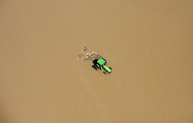
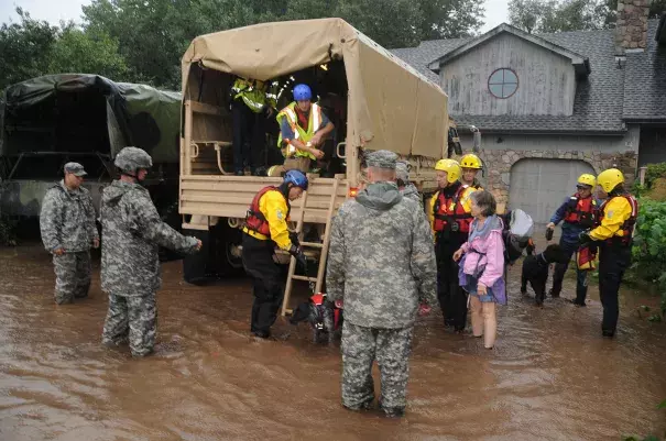
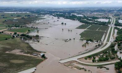
In September 2013, a slow-moving storm brought major flooding to Colorado's Front Range, from Colorado Springs to Fort Collins. Boulder County was the hardest hit. The Boulder floods and surrounding areas' floods were the result of several days of record or near record rainfall and already saturated soil at higher ground, a rarity for September.
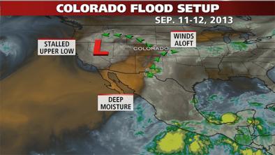
Scientists say we should expect more extreme precipitation events like this one due to increases in ocean and air temperature that add water and energy to storms. In August 2013, sea surface temperatures off the west coast of Mexico where the storm developed were over 86°F (30°C) and more than 1.8°F (1°C) above normal. The high ocean temperatures led to a large pooling of water that ended up flowing north into Colorado thanks to unusual circulation patterns.
Atmospheric water vapor, which is important for determining precipitation amounts, was also unusually high in the Boulder region during the flooding event. The total column water vapour—or height the water in the air would occupy if condensed into liquid and spread out evenly—was 7.5 cm in the Boulder region, according to NASA satellites.
Increased sea surface temperature and atmospheric moisture content are two well-established signals of climate change
The ocean absorbs 93 percent of the excess heat due to global warming, and the strongest warming is found near the sea surface—0.2°F (0.11°C) per decade in the upper 75 meters between 1971 and 2010. Surface warming is closely associated with an increase in the flux of heat from the ocean surface to the atmosphere, which fuels the air with more energy and moisture.
As for the air, it can hold 7 percent more water per one degree Celsius increase in temperature. The additional moisture gets carried by winds and converges to a point where storms are favored. The convergence of increased water vapor leads to more intense precipitation and risk of heavy rain and snow events.
Related Content