Ellicott City Floods May 2018
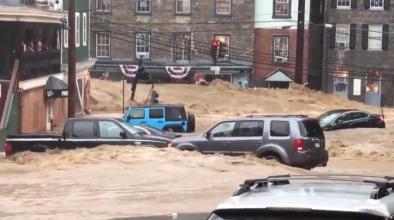
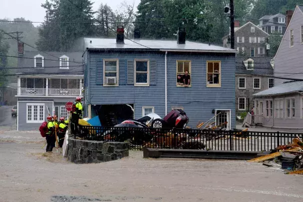
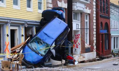
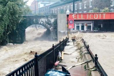
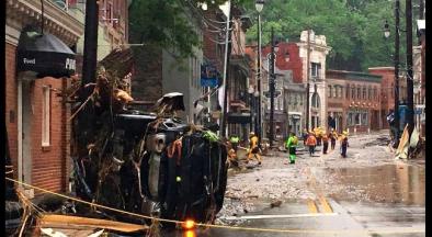
Heavy precipitation, up to 10.38 inches[1], fell in a matter of hours in the Ellicott City region of Howard County, Maryland, on May 27, 2018. A 39-year-old man was reported missing, and Howard County officials estimated that flooding caused at least $22.4 million in damages.[3]
Preliminary rainfall totals indicate the observed precipitation was so extreme that one would expect such totals only once every 1,000 years.
Expectations based on historical data, however, may not be indicative of what we can expect in a warmer climate. The Ellicott City region has now seen two 1,000 year rainfall events in just two years. Climate change, along with stalled weather patterns and the region's flood-prone geography, contributed to these extreme flooding events.[2]
Climate change increases the risk of flooding by increasing the frequency of extreme precipitation, which causes water to runoff over land. Warmer air holds more water, leading to stronger and more frequent heavy precipitation events.


Climate science at a glance
- There is a global trend in stronger and more frequent heavy precipitation events, and it has been firmly attributed to climate change.[1][2][3][4][5][6][7]
- The direct influence of global warming has also been identified on seasonal and annual mean precipitation extremes in the North-Central and Eastern US.[8]
- The Northeast has seen the greatest increase in heavy precipitation of any region in the country.[9]
- The amount of daily precipitation falling in the Northeast during the heaviest storms (the heaviest 1 percent) increased by 55 percent from 1958 to 2016.[10]
Climate signal breakdown
 Climate signal: extreme precipitation
Climate change contributes to increased flooding because warmer air holds more water, leading to stronger and more frequent precipitation events. Average global increase in precipitation is similar to the increase of the amount of water the atmosphere can hold at higher temperatures (the Clausius–Clapeyron relation), about 7 percent per degree Celsius.[11]
The number of record-breaking rainfall events globally has significantly increased in recent decades, and the fingerprint of global warming has been documented in this pattern.[1][2][3][4][5][6][7]
In 2010, there was an estimated 26 percent chance that a new rainfall record was due to long-term climate change.[1] For 2°C of warming, the fraction of precipitation extremes attributable to human influence rises to about 40 percent.[3]
Scientists have identified the direct influence of anthropogenic warming in 41 percent of global records for 5-day precipitation totals.[2]
[T]he water vapor content of the atmosphere, as a whole, has increased and scientific studies have shown a statistically meaningful uptick in the frequency of extreme rain events over the eastern United States. Statistically, over the long term, these types of extreme floods are probably becoming more common, in areas that are normally rainy as a result of global warming.
- Dr. Jeff Halverson, Severe Weather Meteorologist [12]
Observations consistent with extreme precipitation
 The National Weather Service issued a flash flood emergency for Ellicott City, Maryland, on May 27, after 3 to 6 inches of rain fell in just two hours.[13]
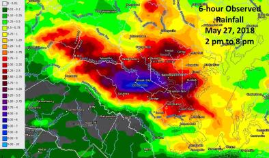
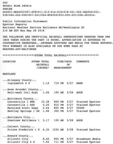
6-hour rainfall estimates of up to 7 inches were observed[14], and unofficial 15-hour rainfall totals for Catonsville and Ellicott City were 10.38 and 8.40 inches respectively.[15]
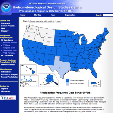
These initial observations, when compared to the point precipitation frequency table for Ellicott City below, indicate that maximum precipitation totals over just a few hours were so extreme that you would only expect such totals once every 1,000 years. The Ellicott City region has seen two such storms just two years apart.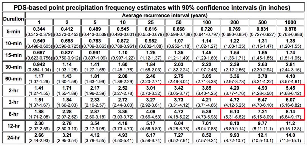
Related Content