Typhoon Yutu October 2018
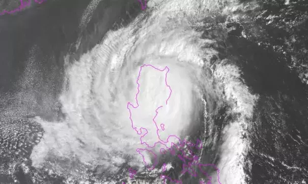
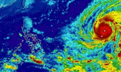
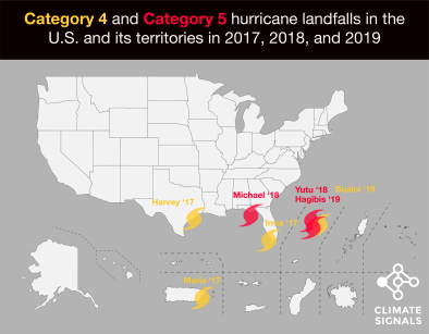
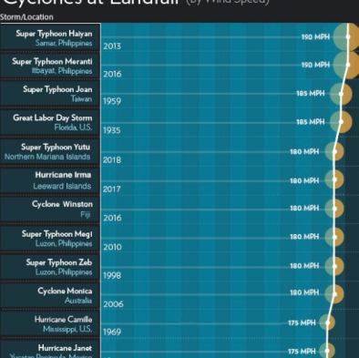
Typhoon Yutu struck the Northern Mariana Islands (Tinian and Saipan) the morning of October 25, 2018[1] as the largest storm to hit U.S. soil since 1935.[1] It's eye covered the whole island of Tinian and part of Saipan all at once.[1] Typhoon Soudelor had hit the same area just three years prior.[1]
Climate change affects tropical cyclone activity and amplifies the damages in several ways including: (1) elevating storm surge, via sea level rise, which greatly extends the storm's reach along low-lying areas, (2) increasing the rainfall that drops during the storm, and (3) increasing sea surface temperatures, which raises the maximum potential energy that a storm can reach.

Climate science at a glance
- Sea level rise, combined with coastal storms, has increased the risk of erosion, storm-surge damage, and flooding for coastal communities.
- Global warming is increasing water vapor in the air, which in turn is fueling extreme rainfall, increasing the threat of flooding driven by hurricanes.[1]
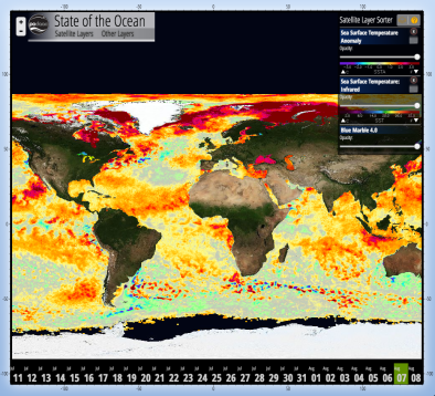
- Rising sea surface temperatures are increasing the potential energy available to passing storms.[2]
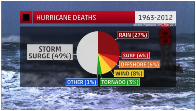
- From 1963 to 2012, 88 percent of storm-related fatalities occurred in water-related incidents; storm surge caused 49 percent and freshwater floods due to heavy rainfall caused 27 percent.[3][4]
Climate signal breakdown
Climate signal #1: Storm Surge Increase
The most important impact of tropical cyclones in coastal regions is storm surge, which accounted for 49 percent of storm-related fatalities between 1963 and 2012.[3][4][5] Increases in storm surge related to climate change can be due to rising seas, increasing size, and increasing storm wind speeds.[5][6]
Climate change has already contributed about 8 inches (0.19 meters) to global sea level rise,[7] and this has dramatically amplified the impact of cyclones by increasing baseline elevations for waves and storm surge.[7][8][9][10] A small vertical increase in sea level can translate into a very large increase in horizontal reach by storm surge depending upon local topography. For example, sea level rise extended the reach of Hurricane Sandy by 27 square miles, affecting 83,000 additional individuals living in New Jersey and New York City[8] and adding over $2 billion in storm damage.[10]
Climate signal #2: Extreme Precipitation
Climate change is fueling extreme rainfall and dramatically increasing rainfall across many types of storms, and an increase in rainfall rates is one of the more confident predictions of the effects of climate change on tropical cyclones.[1][5]
As the global average temperature increases, so too does the ability of the atmosphere to hold and dump more water when it rains.[1] Atmospheric water vapor has been increasing.[11][12] And the observed increases have been studied and formally attributed to global warming.[7][13][14]
Five attribution studies found that global warming added to the deluge of rainfall dumped by Hurricane Harvey.[15][16][17][18][19]
Climate signals #3 and #4: Sea Surface Temperature Increase and Intense Northwest Pacific Typhoon Frequency Increase
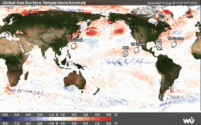
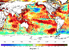
Tropical cyclones are fueled by available heat. Warming seas have increased the potential energy available to passing storms, effectively increasing the power ceiling or speed limit for these cyclones.[5][20] In parallel there has been a global increase in the observed intensity of the strongest storms over recent decades.[21][22]
The fingerprint of global warming has been identified in the accumulated cyclone energy (ACE) in 2015 in the Northwest Pacific.[23] In 2015, accumulated cyclone energy (ACE) in the western North Pacific was extreme, and human-caused climate change "largely increas[ed] the odds of the occurrence of this event," according to the fifth edition of "Explaining Extreme Events from a Climate Perspective" by the Bulletin of the American Meteorological Society.[23]
A number of studies have identified increasing trends in intense typhoon frequencies in the Northwest Pacific.[24][25][26][27][28] A 2016 study documented the tight connection between increasing ocean warmth and the increasing intensity of typhoons in the western North Pacific, finding that "the energy needed for deep convection is on the rise with greater heat and moisture in the lower tropical troposphere," and that as a result, super typhoons in the region are, "likely to be stronger at the expense of overall tropical cyclone occurrences."[24]
Related Content


