Atmospheric River Change
It is normal for the western US to receive most of its annual precipitation from atmospheric rivers (ARs), which are long, narrow bands of moisture in the atmosphere that extend from the tropics. But global warming is changing how ARs behave, increasing risks to communities from flooding and landslides and threatening the region's vital water resources and infrastructure.
Read More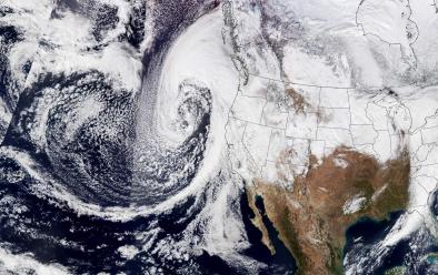
Climate science at a glance
- Atmospheric rivers (ARs) cause most of the flood damage in the Western United States.
- A warmer atmosphere drives more extreme precipitation across all storm types, increasing the risk of flooding.
- The amount of moisture carried by atmospheric storms from the North Pacific and released in the western US increased from 1948–2017. The increase is linked to ocean surface warming.[1]
- Atmospheric river storms are projected to increase in intensity and duration in California in a warming climate, with the most intense atmospheric river storms becoming more frequent.
- Rising temperatures mean more precipitation falls as rain instead of snow, increasing runoff risks associated with atmospheric river storms.[2]
- Overall conditions in California become more polarized in a warming climate, shifting toward both more drought and more flood, often alternating.
- Scientists identified the fingerprint of global warming on the atmospheric river storm that broke meteorological and hydrological records in the British-Irish Isles.[3]
Background
What are atmospheric river storms?
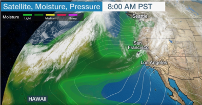
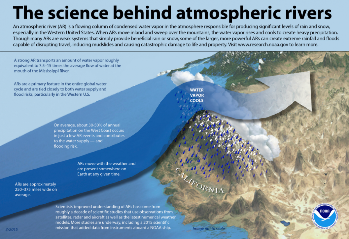
Atmospheric rivers are wide paths of moisture in the atmosphere composed of condensed water vapor. Globally, atmospheric rivers are the largest transporters of freshwater and also distribute heat energy from equatorial regions toward the poles. They bring extreme precipitation to land areas they pass over. They occur globally but are especially significant on the West Coast of the United States, where they deliver 30 percent to 50 percent of annual precipitation.
What are the impacts of atmospheric river storms in the western US?
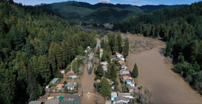
Atmospheric rivers can deliver large amounts of precipitation in a short amount of time with major impacts including flooding and landslides that cause catastrophic damage to life and property.[4][5][6][7][8] In the western US, atmospheric river events have been identified as the primary cause of flooding.[9] Between 1978 and 2017, the 10 most intense atmospheric rivers caused nearly half of all flood damage in the West.
In California, ARs deliver up to one-half of the state's entire annual precipitation over the course of only 10 to 15 days.[10] Between 1996 and 2007, all seven declared floods on California's Russian River were linked to atmospheric rivers.[7] A longer term analysis showed that of 39 declared floods on the Russian River since 1948, 87 percent were caused by atmospheric rivers.[11]
How does climate change affect atmospheric river storms?
Extreme precipitation is increasing worldwide. Across the United States, observational data shows an increase in the intensity and frequency of extreme precipitation events.[12] This is because warmer air has the capacity to hold and release more moisture. For each 1°C of warming, saturated air contains seven percent more water vapor.[13] Therefore, a given volume of warmer air has the capacity to drop greater amounts of rain and snowfall than the same volume of cooler air.[14] Warmer air also provides more energy (known as latent heat) to drive storms,[14] and increases the amount of precipitation that falls as rain instead of snow.[2]
US atmospheric river trends and climate change
As the climate warms, ARs are expected to form in more rapid succession and grow more intense as they become wetter, longer, and wider. There is some indication that this is already happening in association with observed Pacific Ocean warming.[1]
An August 2017 study spanning seven-decades of data revealed a rising trend in land-falling atmospheric rivers consistent with a long-term warming of the North Pacific, which sends more water vapor to North America.[1] The study also identified an increase in the amount of moisture that atmospheric storms transport.
A July 2015 study found that climate change may increase horizontal water vapor transport by up to 40 percent in the North Pacific, due mainly to increases in air moisture.[15]
ARs in the western US warmed substantially from 1980 to 2016. Warmer storms have important impacts on water resources, such as more precipitation falling as rain instead of snow, causing early snowmelt and flooding.
ARs distribute heat energy from equatorial regions toward the poles. Climate change is leading to shifts in energy flows, expanding regions of stable, warm and dry air in the subtropics, which shifts atmospheric rivers poleward.
Studies attribute changes in atmospheric river storms to climate change
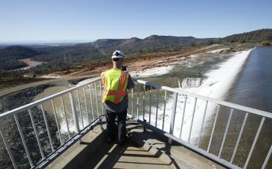
- (Huang et al. 2018): An unusually warm AR preceded the Oroville Dam crisis and played a major role in the dam’s failure. Runoff in the watershed supplying the Oroville dam during the peak precipitation immediately prior to the dam failure was one-third greater than it otherwise would have been were it not for global warming.[16]